The Maps of Monaghan
![]()
![]()

Rossnalogh East (Click to Enlarge)

Faltagh Town Land (Click to Enlarge)

Newbliss Town (Click to Enlarge)
Detail Maps around Aghabog (including houses)
These are larger maps that show the town lands of Rossnaglogh East, Corravilla, Faltagh. Also attached is a region map that also includes Tonagh Townland.
These are color maps that I think were created between 1829 and 1842. What is interesting is you can see the buildings and other features. In Faltagh, for example, you can see the bog. The Smyths appear to have leased land in and around this bog in both Faltagh and Rossnaglogh East. Rossnaglogh East is just north and adjacent to Faltagh. For additional information, refer to:
The map of Rossnaglogh is interesting too. There was a John Smith (Smyth) leasing land in mid-nineteenth century Ireland here. I think it was located around where you see the number '125' on the map (easier to view after clicking on maps to enlarge). That may also indicate where they had their housing. Other names that appear in this townland Kearns (Australian Smyth) and McPhillips. The McPhillips leased land in the eastern section of Rossnaglogh
In Corravilla we find McPhillips leasing a large part of its northern and western section.

Faltagh - Rossnalogh (Click to Enlarge)
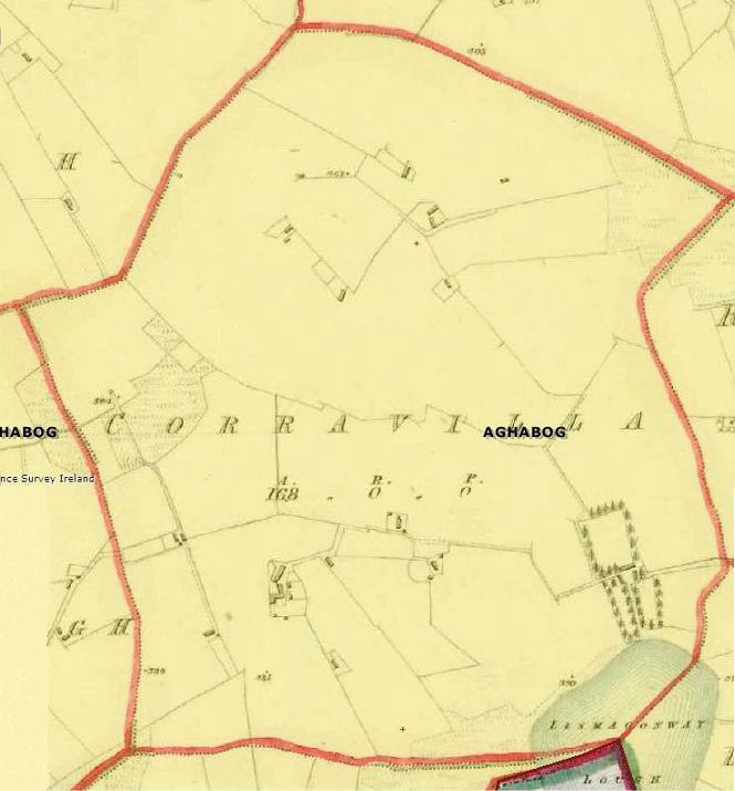
Corraville (Click to Enlarge)

Kileven Glebe (Click to Enlarge)


 Killeybegs (Click to Enlarge)
Drumbarity Housing
Ballyara Housing (click to Enlarge)
Killeybegs (Click to Enlarge)
Drumbarity Housing
Ballyara Housing (click to Enlarge)