Additional Information Regarding Newport
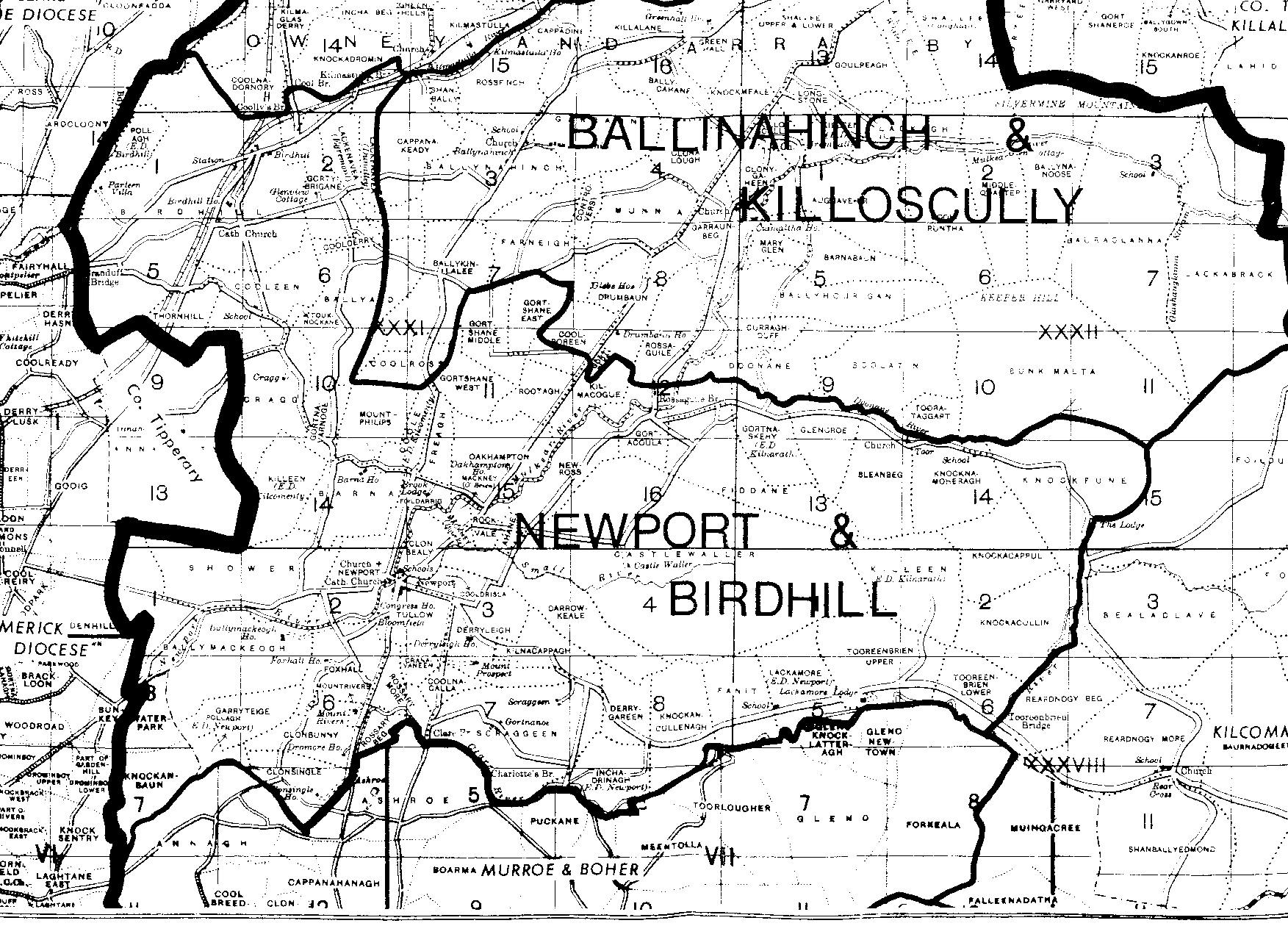
Millie Ryan sent a few additional items for us to include on this web site. The map below is a detailed version of the townlands, schools and churches in the Newport, Tipperary, area. These maps should look familiar as they are newer versions of the 1840s maps represented on this site numerous times.
CLICK TO ENLARGE
|
||||
The Ryans drove around Fiddane, which is the townland that borders Castle Waller, and felt that they had traveled the same path as some of our ancient ancestors. There is another picture of Castle Waller (old Ryan castle) provided, as well.
Fiddane is also where the Irish census shows the James and Anne Ryan family living in the 1850s, although the Catholic records show it to be Gortnaskehy. Additionally, we also know that James Ryan leased land inside Gortnaskehy from the Ballyvowne Estate. As we don't know specifically the farm house they lived in, we suspect that they lived along the borders of Fiddane and Gortnaskehy townlands.
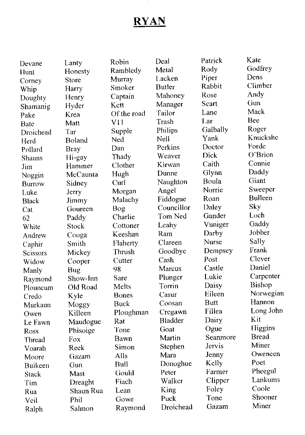
Also, Don and Millie sent a list of Ryan nicknames, which the genealogical societies use because there are so many Ryans in Tipperary. Thomas Tanner, the current resident of Castle Waller, is part of the "Daddy" Ryan family. Don had asked Mr. Tanner how much land the Ryans possessed at one time, and he responded, "miles". Most likely there are a few family nicknames that we link into.
CLICK TO ENLARGE
|
|
|
||